


Introduction:
Keyhole Markup Language (KML) and Keyhole Markup Language Zipped (KMZ) are file extensions. KML files store data in XML format, whereas KMZ files store data in a compressed format. These files allow you to plot points, draw lines, and create shapes on a map, making them essential for showcasing spatial information. In this post, we’ll see how to import these files into your Google Map and view them.
What are the requirements for importing KML/KMZ files?
KML files contain information about geographic location, notation, and image overlays. To open KML files, you can either use Google Earth or Google Maps. However, in this post we’ll see how to import it in Google Maps.
Importing KML and KMZ Files in Google Maps:
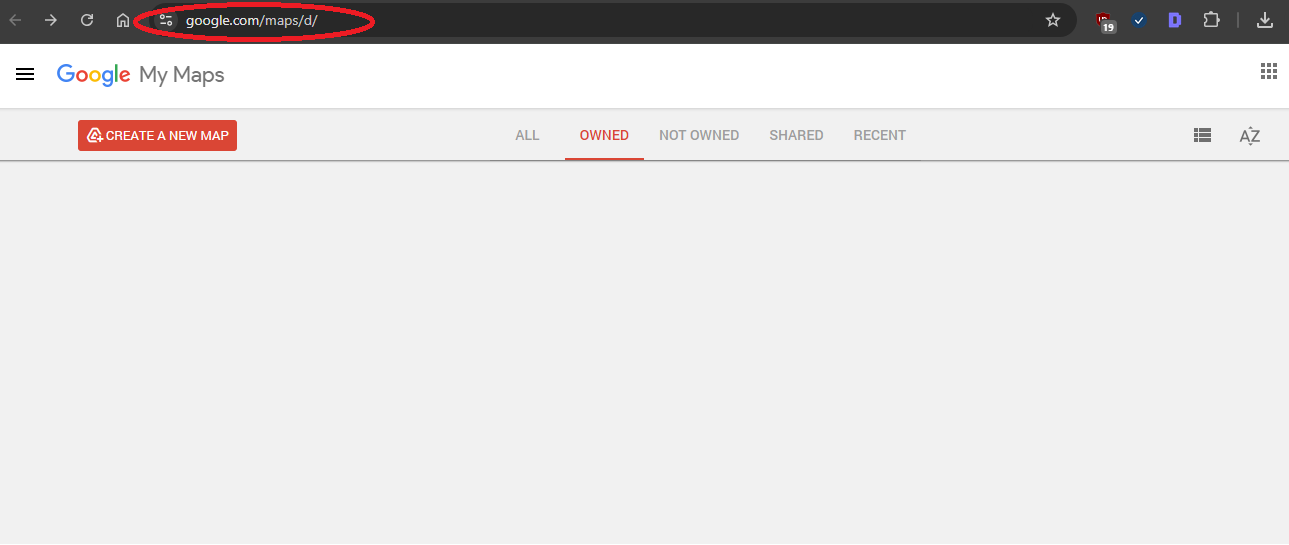
- Open Google Maps on your PC/laptop. (Link: https://www.google.com/maps/d/) You will get a page like this:
Alternatively, you can also visit Google Earth (https://earth.google.com/web/) and select New and open a local KML file from your computer.
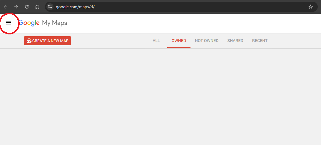
- Click on the menu icon (three horizontal lines) in the top-left corner.
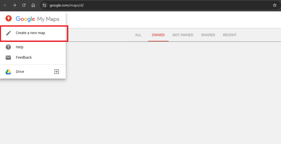
- Select the “Create a new map” option.
- You will get a Google map page like the one below. Select "Import.".
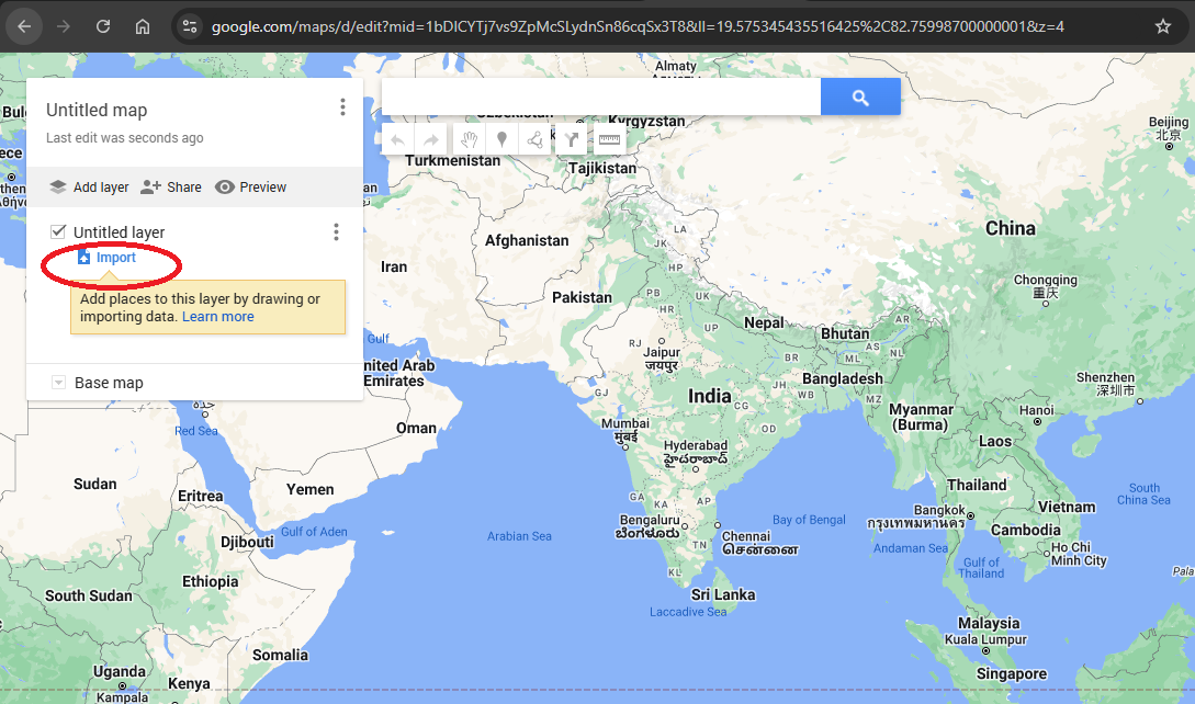
In the import menu, click on the "KML or KMZ file" that you already have from your computer and click "Open.".
The file will be imported into Google Maps and will appear as a new layer.

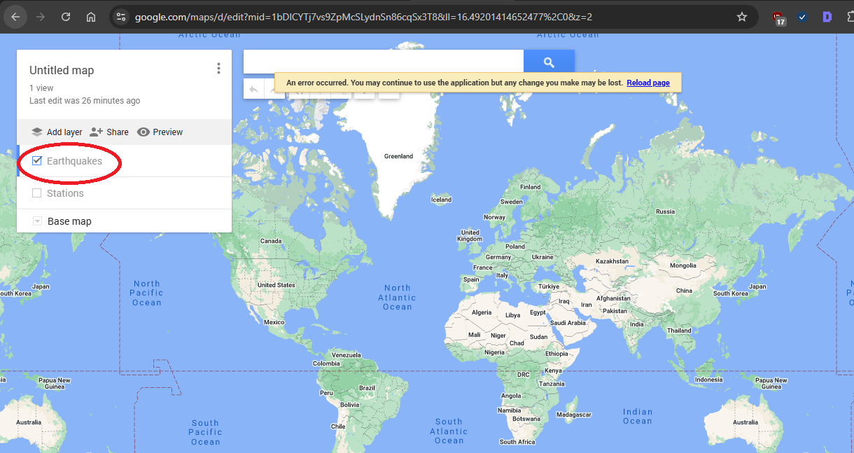
You can view the imported data by clicking on the layer's name in the "Layers" panel on the left side of the screen.
You can also change the layer's visibility by checking or unchecking the box next to its name.
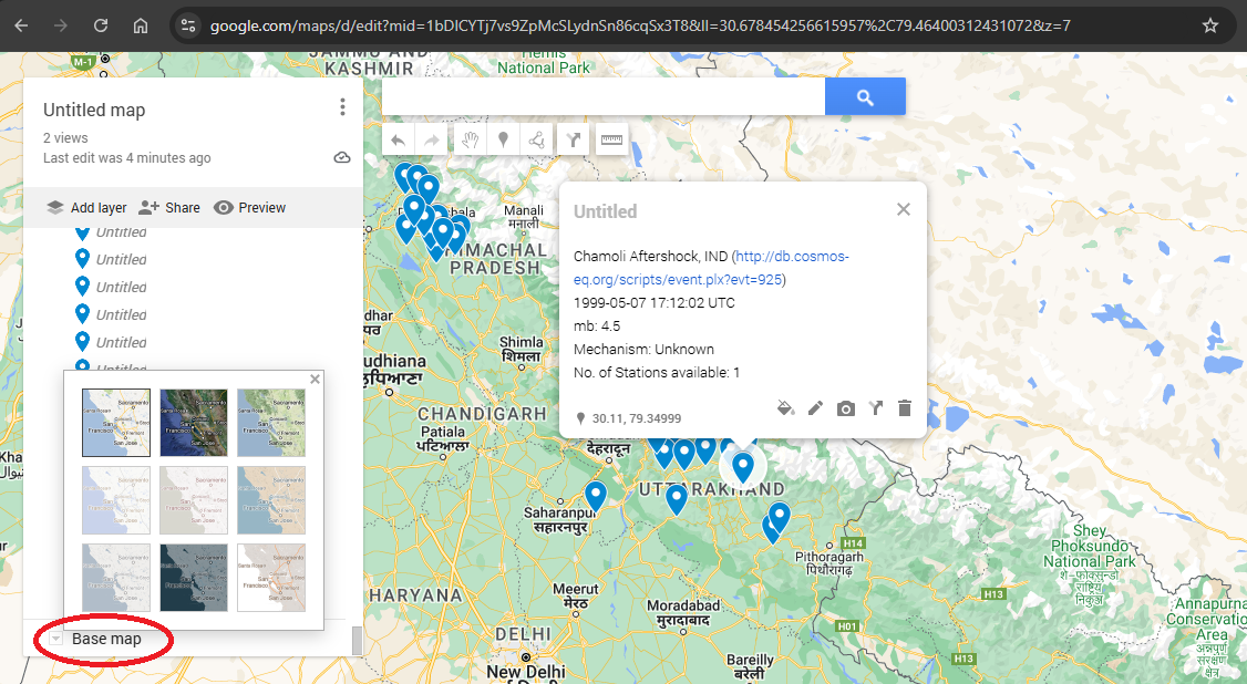
- You can also change the map view by selecting the Base Map view option.
What is the purpose of using KMZ/KML files?
KMZ files are like ZIP files. KMZ files compress content for faster downloads and enable the inclusion of multiple files, such as images, with your KML data.
You can save your KML file and any images you want to include as a KMZ file. Do this when posting a file on the web, emailing an attachment to a colleague, or preparing for a presentation in front of a live audience. When you make a KMZ file, you don't have to include images. A KMZ file is a compressed KML file, which makes it smaller and faster to download.
How to Create a KMZ file?
It is very simple to create KMZ files using Google Earth. When you save a location or folder from your Places panel, you can choose to save it as either a KMZ or KML file. This is the same as the web browsers allowing you to save complete web pages in HTML format, including images and style sheets, or just the HTML for a single web page.
Conclusion:
By following these steps, you can upload and view your KML/KMZ file in Google Maps. For tracking the spread of an environmental issue, planning a city's infrastructure, or simply exploring points of interest, this allows you to easily integrate your data and gain valuable information on Google Maps.
FAQs
1. What is a KML file?
A KML file is a Keyhole Markup Language file. It is an XML-based file format used to store geographic data such as points, lines, shapes, and images. KML files can be viewed in Google Earth and Google Maps.
2. What is a KMZ File?
A KMZ file is a Keyhole Markup Language Zipped file. It is a compressed version of a KML file. KMZ files can be viewed in Google Earth and Google Maps.
3. How do I import a KML or KMZ file into Google Maps?
To import a KML or KMZ file into Google Maps, follow these steps:
Open Google Maps on your computer.
Click on the menu icon in the top-left corner.
Select "Create a new map."
Click on "Import."
Select "KML or KMZ file" and click "Open."
Select the KML or KMZ file you want to import.
Click "Open."
4. How do I view the imported data in Google Maps?
Once you have imported a KML or KMZ file into Google Maps, you can view the imported data by clicking on the layer's name in the "Layers" panel on the left side of the screen.
5. How do I change the visibility of a layer?
You can change the visibility of a layer by checking or unchecking the box next to its name in the "Layers" panel.